


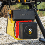
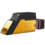
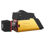
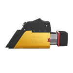
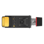

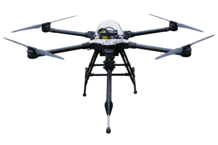
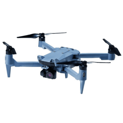
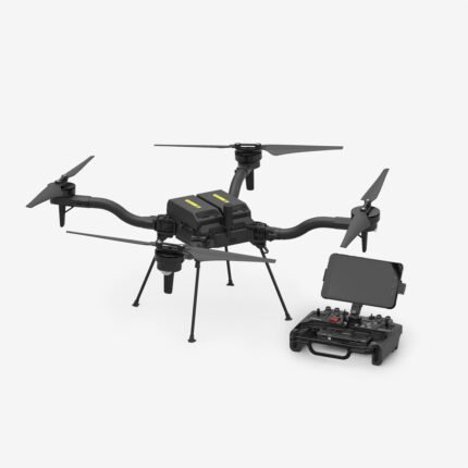
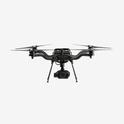
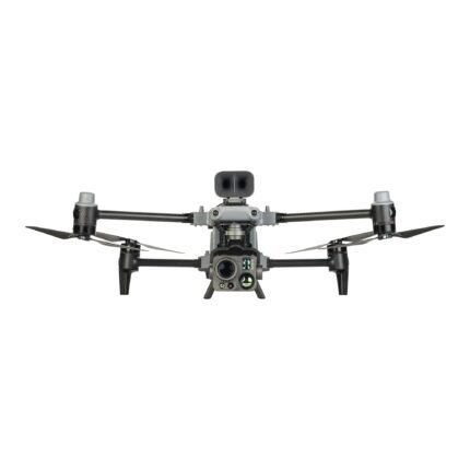
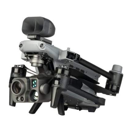
YellowScan® Vx15-300 Integrated System
$68,340.00
180 in stock
YellowScan® Vx15-300 Integrated System | The Long Range, High Precision UAV LiDAR Solution Made for Adventurers
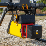
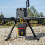
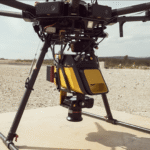
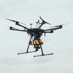
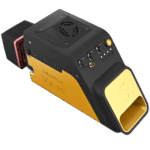
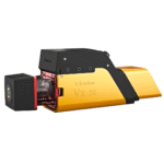
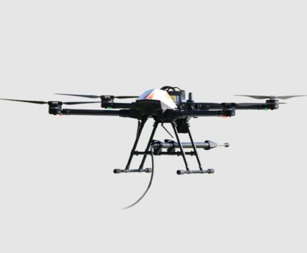
The YellowScan® Vx15-300 is a fully-integrated, easy-to-use LiDAR system that includes the renowned RIEGL MiniVUX-3UAV laser scanner and Applanix UAV IMU APX-15. Ideally suited for high precision surveys such as civil engineering. Coupled with the DJI M300 it allows over 25min flight time maximizing your survey production.
Key Features:
- High Precision Point Cloud
- Calibrated Intensity Value
- Maximized Range
- Lightest System in the Vx Series, with 360° FOV
- Single Board GNSS-Inertial Solution
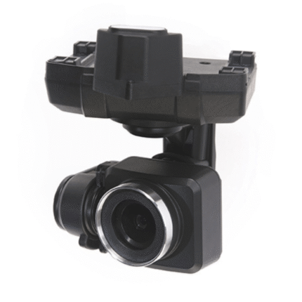
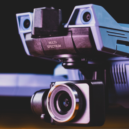
- Technology Inside: Applanix APX-15UAV / RIEGL MiniVUX-3UAV
Designed to Fit Any UAV
The Vx15-300’s light weight allows for easy mounting on a variety of UAVs: multirotor, fixed wing, or helicopter drones.
Enhanced Productivity
The Vx15 series is the ideal solution for high-flight projects with quick data processing needs.
Fit for a Wide Variety of Applications
Ideally suited for applications requiring sharp and accurate descriptions such as in civil engineering.
Data Generation in Just a Few Clicks
Handle pointclouds with YellowScan’s own, all-in-one software solution. Extract, process, and display data immediately after flight acquisition. Applanix POSPac UAV, to post-process GNSS and inertial data for highest accuracy YellowScan CloudStation Essential to generate, visualize, inspect, and export data.
Advanced Calibration
All YellowScan systems are calibrated before shipment and come with a calibration certificate. Be ready to fly your system as soon as you receive it!
YellowScan® – Designed to Innovate
Applications
Mining: Challenging working conditions and the need for precise elevation data in open pit mines make UAV LiDAR solutions the latest go-to surveying tool around the world
Civil Engineering: From the initial planning stages to the final project delivery, LiDAR systems are an asset to the construction industry.
Energy & Utilities: Reduce risks and costs in energy and utilities management.
Corridor Mapping: Mapping the vegetation around powerlines is a major issue for most energy companies, along with mapping of the powerline itself to detect any issues
such as line sagging, damage to cables and to structures.
Forestry: Whether it is a commercial or governmental activity, forest management requires detailed data to make proper decisions.
Archeology: LiDAR technology has changed the face of archeology by making it possible to measure and map detailed landscapes that would otherwise remain hidden under centuries of vegetation.
Environmental Research: This technology has revolutionized conservation and environmental research by providing useful information, as 3D pointclouds, in the quest to save forests, animals, and humans.
Media & Entertainment: Turn real-life objects into digital twins. LiDAR is becoming increasingly popular for creating special effects and realistic digital imagery.
Explore a world of possibilities using YellowScan® LiDAR solutions.
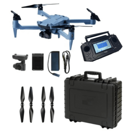
In the Box
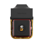
1 – YellowScan Vx15-300 (Multi-echo RIEGL MiniVUX-3UAV Laser Scanner)
1 – Calibrated APX-15 GNSS-inertial board
1 – GNSS antenna and cable
2 – Integrated batteries
1 – Battery charger and data cables
3 – Connectors for external sensor/camera
2 – USB flash drives
1 – Rugged transport case with customized foam
1 – Applanix POSPAC UAV
1 – YellowScan CloudStation Essential
1 Year warranty
Specifications
Laser scanner: RIEGL MiniVUX-3UAV
GNSS inertial solution: Applanix APX-15 UAV
Precision: 1 cm
Accuracy: 5 cm
Typ. flight speed: 5 m/s
Typ. flying height: 80 m
Max. rec. flying height: 100 m
Laser range: Up to 170 m
Laser wavelength: 905 nm
Max. data generated: 1 500 000 points/sec
Scanning frequency: Up to 100 Hz
Weight: 2.4 kg (5.3 lbs) batt. excl.
Size: L 353 x W 106 x H 149 mm
Autonomy: 1.5 hour typ.
Power consumption: 25 W
Operating temperature: -10 to +40 °C
| Vx15-300 | 100 kHz | 200 kHz over 360° | 200 kHz over 180° | 300 kHz |
| Shots per second | 100k over 360° | 200k over 360° | 100k over 180° | 100k over 120° |
| Scanner field-of-view | 360° | 360° | 180° | 120° |
| Typ. flying height natural targets ≥ 20% |
100 m | 85 m | 100 m | 100 m |
| Point density @50m AGL, 5m/s, 90°FOV |
50 pts/sqm | 100 pts/sqm | 100 pts/sqm | 150 pts/sqm |


MAECENAS IACULIS
Vestibulum curae torquent diam diam commodo parturient penatibus nunc dui adipiscing convallis bulum parturient suspendisse parturient a.Parturient in parturient scelerisque nibh lectus quam a natoque adipiscing a vestibulum hendrerit et pharetra fames nunc natoque dui.
ADIPISCING CONVALLIS BULUM
- Vestibulum penatibus nunc dui adipiscing convallis bulum parturient suspendisse.
- Abitur parturient praesent lectus quam a natoque adipiscing a vestibulum hendre.
- Diam parturient dictumst parturient scelerisque nibh lectus.
Scelerisque adipiscing bibendum sem vestibulum et in a a a purus lectus faucibus lobortis tincidunt purus lectus nisl class eros.Condimentum a et ullamcorper dictumst mus et tristique elementum nam inceptos hac parturient scelerisque vestibulum amet elit ut volutpat.


Reviews
There are no reviews yet.