


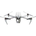


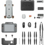


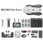
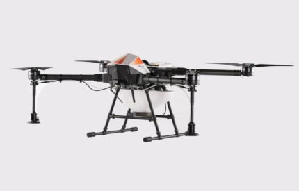
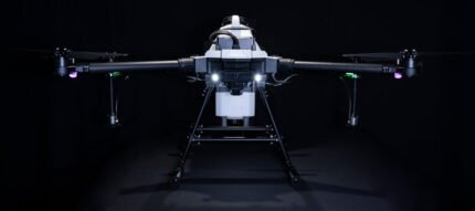
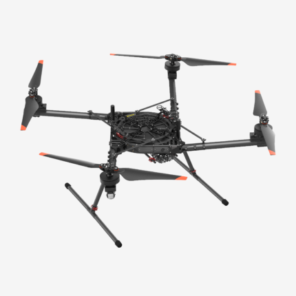
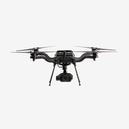
Autel – Evo MAX 4T XE
$5,399.40
180 in stock
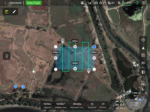
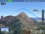
Autonomous Path Finding
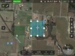
Autel’s Autonomy Engine collects surrounding environmental data and plans 3D flight paths through complex environments such as mountains, forests, and buildings. Use cases include rapid 3D scene reconstruction, public safety overwatch, industrial inspection, and land surveying.
Navigation in GPS Denied Environment
Advanced sensors allow the EVO Max 4T XE to navigate within hardened structures, underground, or in environments without GPS.
Accurate Object Identification and Tracking
Based on Autel’s AI recognition technology, the EVO Max 4T can automatically identify and lock onto different types of targets such as heat sources, moving people, or vehicles and achieve high-altitude tracking and data collection for law enforcement.
Specifications:
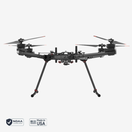
Aircraft
|
Weight |
3.5 lbs (1600g, battery and gimbal included) |
|
Dimensions |
576*660*149 mm (folded, incl. propellers) 340*407*148 mm (folded, excl. propellers) 257*136*133 mm (unfolded, excl. propellers) |
|
Diagonal Wheelbase |
1.52 ft (464mm) |
|
Max Ascent Speed |
8m/s |
|
Max Descent Speed |
6m/s |
|
Max Horizontal Speed (windless near sea level) |
23m/s |
|
Max Service Ceiling Above Sea Level |
23000ft (7000m) |
|
Max Flight Time (windless) |
42 mins |
|
Max Hovering Time (windless) |
38 mins |
|
Max Wind Resistance |
27mph* *Takeoff and landing can withstand wind speeds up to 27 mph (12 m/s). |
|
IP Rating |
IP43 |
|
Max Tilt Angle |
35° |
|
Max Angular Velocity |
Pitch: 300°/s; Yaw: 120°/s |
|
Operating Temperature |
-4°F to 122°F (-20℃ – 50℃) |
|
Operating Frequency |
2.4G/5.2G*/5.8G/900MHz* |
|
Transmitter Power (EIRP) |
2.4GHz:<33dBm(FCC), <20dBm(CE/SRRC/MIC) 5.8GHz:<33dBm(FCC), <30dBm(SRRC), <14dBm(CE) 5.15-5.25GHz: < 23dBm(FCC/SRRC/MIC) 5.25-5.35GHz:<30dBm(FCC), <23dBm(SRRC/MIC) |
|
Hovering Accuracy |
Vertical: ±0.1 m (Vision System enabled); ±0.3 m (GPS enabled); ±0.15 m (RTK enabled); Horizontal: ±0.15 m (Vision System enabled); ±0.3 m (GPS enabled); |
Gimbal
|
Mechanical Range |
Pan: -135° to 45° Tilt: -45° to 45° Roll: -45° to 45° |
|
Controllable Range |
-90° to 30° |
|
Stable system |
3-axis mechanical gimbal (pan, tilt, roll) |
|
Max Control Speed (pitch) |
200º/s |
|
Angular Vibration Range |
<0.005° |
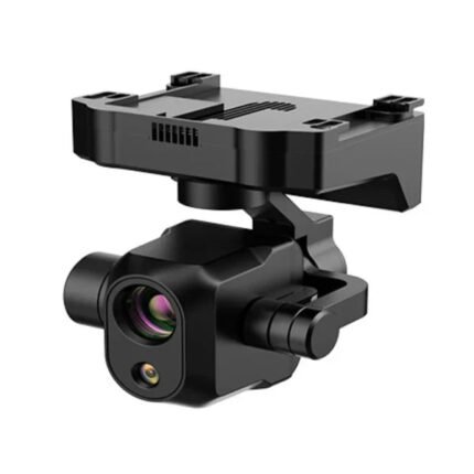
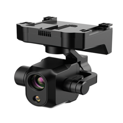
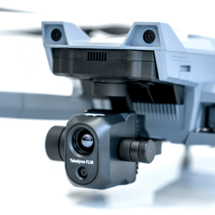
Zoom Camera (Telephoto)
|
Sensor |
1/2″ CMOS, Effective pixels: 48M |
|
Lens |
Focal length: 11.8-43.3mm (35mm, equivalent: 64-234mm) Aperture: f/2.8-f/4.8 |
|
Exposure Compensation |
±3EV 0.3EV/step |
|
ISO Range |
Normal Mode: Auto: ISO100 ~ ISO6400 Manual: Photo: ISO100 ~ ISO12800 Video: ISO100 ~ ISO6400 |
|
Shutter Speed |
Photo: 8s ~ 1/8000s Video: 1s ~ 1/8000s |
|
Max Photo Size |
8000×6000 |
|
Max Video Resolution |
7680×4320 |
Wide Camera
|
Sensor |
1/1/2″ CMOS, Effective pixels: 48M |
|
Lens |
DFOV: 85° Focal length: 4.5 mm (equivalent: 23 mm) Aperture: f/2.8 |
|
Exposure Compensation |
±3EV 0.3EV/step |
|
ISO Range |
Auto: Photo: ISO100~ISO6400 Video: ISO100~ISO64000 (Night scene mode: up to ISO64000) Manual: Photo: ISO100~ISO12800 Video: ISO100~ISO6400 |
|
Shutter Speed |
Photo: 8s ~ 1/8000s Video: 1s ~ 1/8000s |
|
Max. Video Resolution |
3840×2160 |
|
Photo Size |
8192*6144 4096*3072 |
Thermal Camera
|
Thermal Imager |
Uncooled VOx Microbolometer |
|
Lens |
DFOV: 61° Aperture: 9.1mm Focus: f/1.2 |
|
Infrared Temperature Measurement Accuracy |
26.6~37.4 ℉ or reading ±3% (using the larger value) @ambient temperature -4℉ to 140℉ |
|
Video Resolution |
640*512 |
|
Photo Size |
640*512 |
|
Pixel Pitch |
12 um |
|
Temperature Measurement Method |
Center measurement, pot measurement, rectangular measurement |
|
Temperature Measurement Range |
-4℉ to 302℉, 32℉ to 1022℉ (-20°C to 150°C, 0 to 550°C) |
|
Temperature Alert |
High and low temperature alarm thresholds, reporting coordinates and temperature values |
Laser Range Finder
|
Measurement Accuracy |
±1m |
|
Measuring Range |
1.2km |
Image Transmission
|
Operating Frequency |
2.4G/5.2G*/5.8G/900MHz* *5.2GHz is only applicable for FCC, CE, and UKCA regions. 900MHz is only applicable for FCC regions. |
|
Max Transmission Distance (unobstructed, free of interference) |
20km(FCC), 8km(CE) |
|
Independent Networking |
Autel Smart Controller V3 |
|
Transmitter Power (EIRP) |
2.4GHz:<33dBm(FCC), <20dBm(CE/SRRC/MIC) 5.8GHz:<33dBm(FCC), <30dBm(SRRC), <14dBm(CE) 5.15-5.25GHz: < 23dBm(FCC/SRRC/MIC) |
Autonomy
|
Non-GPS Hovering and Manual Flight |
Indoor: Horizontal error ≤3cm (At least have texture at one direction) Outdoor: Daytime: Within 500m flight height, horizontal error < 0.01*height Night: Manual flight is controllable within 100m flight height |
|
Non-GPS Return-to-Home |
Within 500m flight height, horizontal error of Return-to-Home point < 30cm |
|
Automatic Obstacle Rerouting |
High Speed Obstacle Rerouting: Flight speed up to 20m/s when Min. safety distance to obstacle is 1.5m High Precision Obstacle Rerouting: Flight speed could reach 3m/s when Min. safety distance to obstacle is 0.5m |
|
Multi-target Recognition and Tracking |
Target identification types: people, vehicles, boats Number of targets detected: 64 Comprehensive recognition accuracy: > 85% |
Millimeter-wave Radar
|
Frequency |
60Ghz~64Ghz |
|
Size |
38*14*2mm |
|
Weight |
2g |
|
EIRP |
18dbm |
|
Distance Detection Range |
For Obstacle Avoidance:0.2m~100m For Height Measurement:0.05m~200m |
|
Ranging Accuracy |
For Obstacle Avoidance:0.1m For Height Measurement:0.02m |
|
Speed Measurement Range |
± 60m/s(4D Mode);±28m/s(3D Mode); |
|
Speed Measurement Accuracy |
≤1% |
|
Max. Tracking Target Number |
32 |
Visual Sensing System
| Obstacle Sensing Range | Forward/Upward/Downward/Backward/Sideward: 0.2~50m |
| FOV | Forward/Backward/Sideward: 60°(H),80°(V) Upward/Downward: 360°(H),190°(V) |
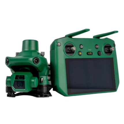
Autel Smart Controller V3
|
Screen |
7.9 inch, 2000nits max. brightness, 2048*1536 resolution |
|
External Battery |
Capacity: 5800mAh Voltage: 11.55V Battery Type: Li-on Energy: 67Wh Charing time: 120mins Intelligent Lithium Ion Battery |
|
Operating Time |
3 hours (Max. brightness) 4.5 hours (50% brightness) |
|
Max Transmission Distance (with interference) |
FCC: 20km CE: 8km |
|
IP Rating |
IP43 |
|
Storage |
128G |
|
GNSS |
GPS+GLONASS+Galileo+Beidou |
|
Operating Temperature |
-20℃ to 40℃ |
|
Wi-Fi Protocol |
WiFi Direct, Wi-Fi Display, 802.11a/b/g/n/ac Support 2 x 2 MIMO Wi-Fi |
|
Operating Frequency |
2.400 – 2.4835 GHz; 5.150 – 5.250GHz; 5.725 ‒ 5.850 GHz |
|
Transmitter Power (EIRP) |
2.400 – 2.4835 GHz FCC/CE:≤20dBm 5.150 – 5.250GHz FCC:≤17dBm 5.725 ‒ 5.850 GHz FCC:≤17dBm CE:≤14dBm |
Aircraft Battery
| Capacity | 8070mAh |
| Voltage | 14.88V |
| Battery Type | LiPo 4S |
| Energy | 120wh |
| Net Weight | 520g |
| Charging Temperature | 5ºC to 45ºC(When the temperature is lower than 10° C (50° F), the selfheating function will be automatically enabled. Charging in a low temperature may shorten the lifetime of the battery) |
| Hot Swap | Support |


Reviews
There are no reviews yet.